

Hermitage Chalk Dissolution Assessment
7th September 2026
Geotechnical • Specialist Services
Our Client
Preliminary-Assessment
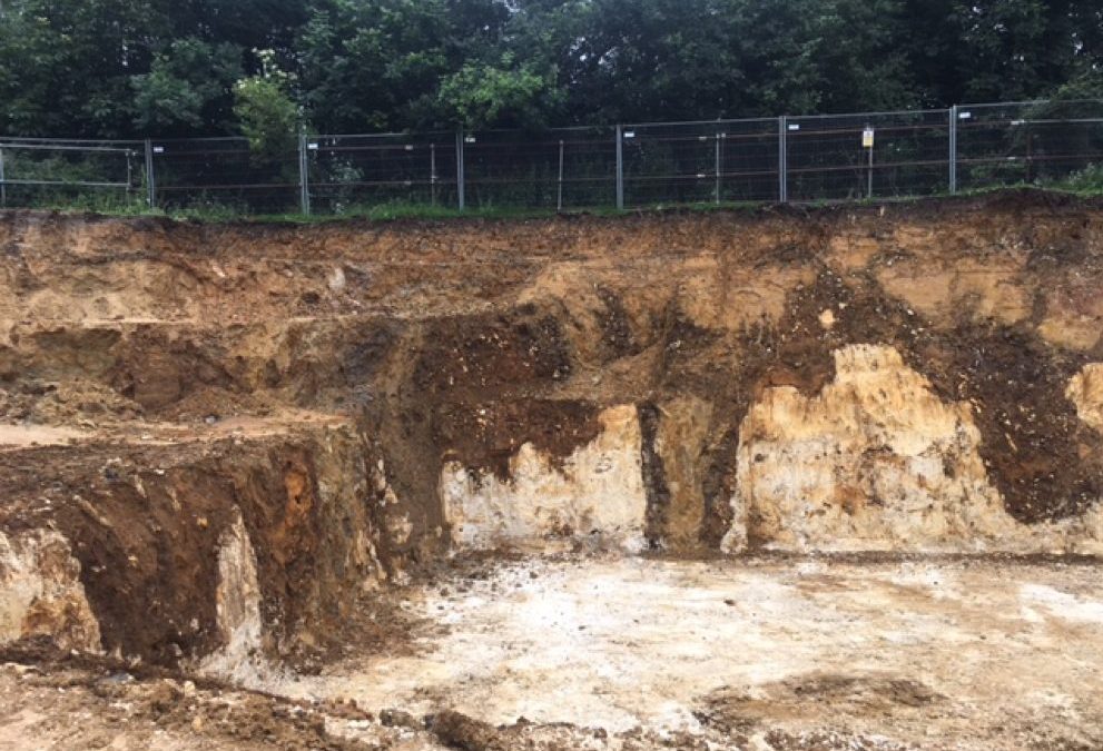
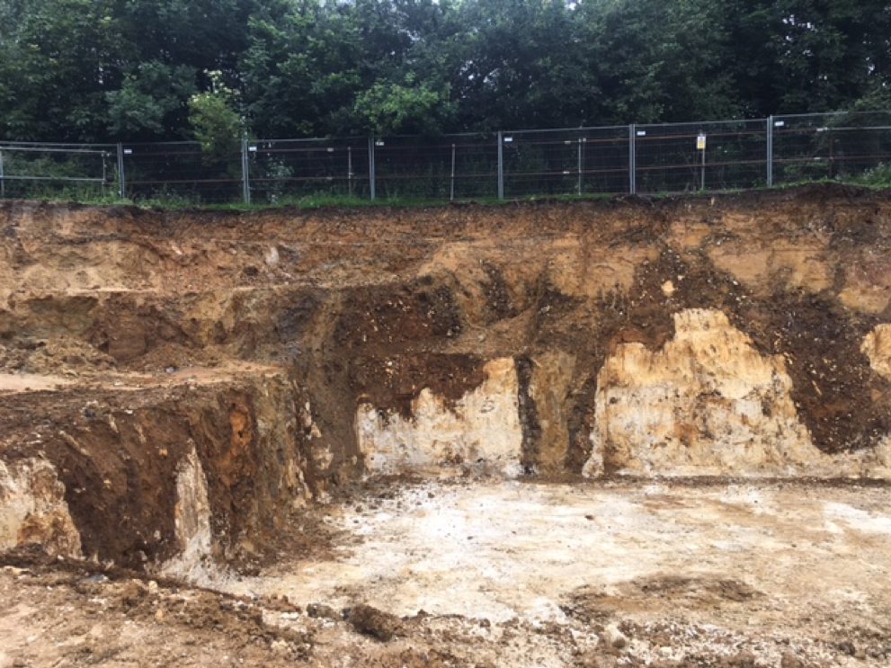
The site was located in Hermitage, a small residential village and civil parish roughly 8km north-east of Newbury, West Berkshire. Geologically, this area is characterised by deposits of the Lambeth Group overlying the Seaford Chalk Formation, which typically indicates a higher risk setting for chalk dissolution. A review of existing records indicated that 19No. natural cavities had been recorded between 164m and 500m of the Assessment Site and 36No. natural cavity locations within 1km. The spatial distribution of these known natural cavities was compared with geology maps, and a potential unidentified feathering margin was speculated closely to the west of the site that could explain the distribution of these known solution features. Additionally, an old investigation had identified multiple surface depressions on the southern site boundary that had been identified as kettle hole features.
Our Challenge
The Ground & Water Approach
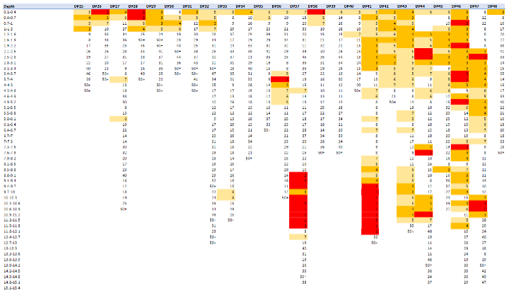
Figure 1 – Super Heavy Dynamic Probe Results. Equivalent SPT “N” Blow counts have been torque corrected and then colour coded with values of <=2 highlighted red, <=5 highlighted orange and <=7 highlighted beige. All values greater that 7 were considered competent and therefore not highlighted. The results show massive variation in the strength characteristics from one location to another at the same depths across the site.
A discrete section of solution feature infill material comprising very loose gravelly sand was confirmed within one of the boreholes at the western end of the site, interpreted as a solution pipe feature. An interpreted zone of weak, brown, sloppy chalk, consistent with the areas of weakness highlighted in the probing was also found to extend across the site at moderate depth. Multiple geological cross sections were produced and found that where the band of weak and sloppy chalk is present, flint beds / granular bands are present overlying the Seaford Chalk Formation. It is suspected that water flowing through these flint beds / granular bands, possibly introduced as a lateral offshoot from the solution pipe feature identified at the western end of the site, is causing partial dissolution and weakening of the chalk.
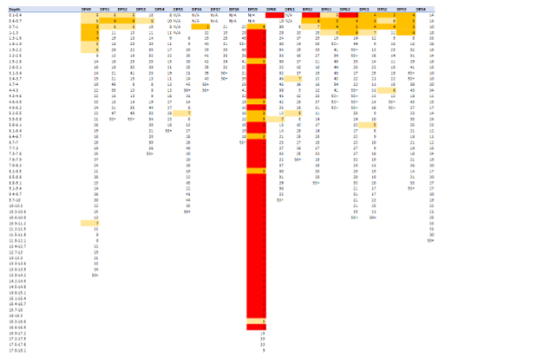
Figure 2 – Super Heavy Dynamic Probe results showing the weak soils associated with the solution feature highlighted in red.
The Outcome
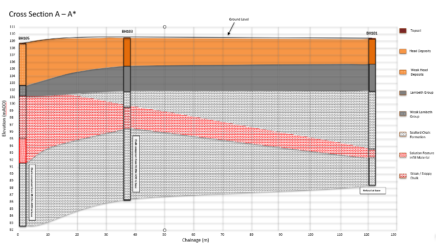
Figure 3 – Geological cross section highlighting the solution pipe feature and band of weak / affected chalk across the site.
As a result, foundation recommendations for the site were separated into four distinct zones based on the level of risk. Zone 1 allowed for traditional shallow footings with no further measures required. Zone 2 shallow footings were suitable but had to allow for a loss of support due to the solution affected chalk at depth. In Zone 3, the superficial deposits were too weak to allow for shallow footings and so a piled foundation scheme (accounting for a loss of support) or grouting of the weak superficial deposits was recommended. Finally, Zone 4 was characterised as the worst affected area where the solution pipe feature was identified and so grouting of this feature to prevent localised areas of instability was recommended alongside shoring of the weaker areas of superficial deposits. The comprehensive site investigation and risk assessment undertaken allowed for the safe recommendations of multiple different foundations schemes, and identified areas where simple traditional foundations were suitable. This approach potential saved the client thousands of £££ compared to a site wide specialist foundation scheme.