
Groundwater flood risk needs more focus
Geoenvironmental • Industry matters • Regulation

Ground & Water Principal Engineer, Miltos Mellios, says: “Densely populated areas, basements and Groundwater…What a combination!”
In this week’s blog post, Miltos explains how the London Borough of Richmond-upon-Thames commissioned a detailed geo-environmental investigation combined with Groundwater monitoring to develop planning policy to reduce the prevalence of Groundwater flooding.
Background
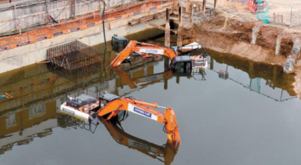
It is accepted that numerous properties in the UK are affected by some amount of Groundwater flooding, particularly homes with basements. Considering that basement development applications in various areas of London have skyrocketed during the past decade, and continue to do so, the requirement for relevant bodies – like geotechnical consultants, contractors and councils – to put additional focus on issues associated with groundwater and its negative effects on buildings and the environment, has never been more important.
 Groundwater tends to flow from areas where the ground level is high, to areas where the ground level is low. In low-lying areas the water table is usually at shallower depths, but during very wet periods, with all the additional groundwater flowing towards these areas, the water table can rise up to the surface causing groundwater flooding.
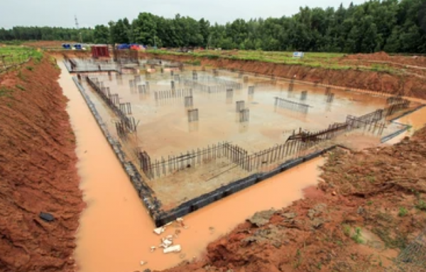
Basements in areas of London are subterranean developments, which are traditionally affected by raised levels of Groundwater, or water which is perched and accumulated at the base of the superficial deposits or reworked/artificially deposited ground, confined by impermeable underlying cohesive deposits: usually of the London Clay Formation. The scope of the desk based review and screening for a proposed development and the intrusive site investigation, should ensure that any issues arising from shallow groundwater, are adequately highlighted and actions are taken during design and construction of the basement.
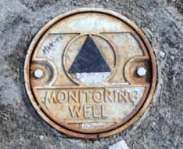
It is evident that appropriate monitoring of groundwater levels, is an integral part of this process. Monitoring ideally will need to be carried out at different times across the year, as Groundwater levels are expected to fluctuate as they are affected by seasonal weather patterns. After monitoring, it is crucial to review and understand the results and assess the level of risk towards the subterranean structure. Experience shows that small amounts of perched water at the base of a monitoring well may be misinterpreted as the presence of a saturated seasonal aquifer or groundwater flooding through accumulation from higher areas. On the other hand it is possible to attribute a false low risk for another vulnerable site, as a result of inadequate accompanying screening.
The basement must be suitably tanked to prevent ingress of Groundwater and also surface water run-off. Due to the potential for Groundwater to collect behind the retaining walls, the basement should be waterproofed and designed to withstand hydrostatic pressures. A de-watering or permitting grout contingency plan, should be included within the Construction Method Statement and considered in the final basement design.
 What about the neighbours…?
It is important to note that the investigation and subsequent solutions, should not only focus on the safe development and function of the site itself, but also ensure that the construction of the development will not substantially affect the groundwater regime and function of flow in the wider area.
The London Borough of Richmond-upon-Thames became aware of subsurface level flood incidents in the Richmond Hill area of the Borough in 2018. Residents reported incidents of flooding within basements and cellars, believed to have been linked to Groundwater and subsurface level developments. Investigations were carried out in 2019 to gain a better understanding of Groundwater and the potential source of subsurface level flooding in the area. Based on the information available, the investigation concluded that the Richmond Hill area may be at risk of Groundwater influenced flooding via, what is known as ‘throughflow’. Throughflow is where Groundwater travels downhill through the aquifers/permeable superficial deposits in the area. If there are no aquifers/permeable superficial deposits for water to flow through, water can continue to travel downhill through the interface of the made ground subsurface level and the clay geology stratum.
As part of the effort to update the guidance on examining such issues and to streamline assessments, following the investigations; several recommendations were made, including the following:
- A Borough-wide flood history survey was undertaken to identify resident experiences with all sources of flooding, including Groundwater flooding;
- Further work was completed to better define the extent of the Richmond Hill area impacted by Groundwater flooding for planning and policy development purposes;
- Planning and policy requirements for basement developments were developed.
Based on the results of the Richmond Hill investigations and the accompanying recommendations, further investigation work was commissioned by the Borough to analyse the risk of Groundwater influenced flooding via throughflow.
(Ref: Further Groundwater Investigations)
 As part of this investigation, an online reporting tool was developed to gather information on all sources of flooding throughout the Borough. A catchment analysis was also undertaken to determine if there are any other catchments, which may also contain developments at risk of flooding via throughflow.
The investigation identified that if subterranean developments take place in upstream areas of catchments identified as ‘throughflow catchment areas’, then properties in the downstream regions of the catchment may be at risk of flooding due to throughflow. As a result, a set of recommended policies and guidance recommendations were developed for these catchment areas. An example is that no basements should extend beyond the curtilage of the site. This means subsurface structures must not extend into areas such as the public highway, public open spaces or cross the site boundary into another site. If the extent of the proposed subsurface structure extends beyond the surface level development, it must not exceed 50% of the garden or open space extent.
The policy is designed to control the extent of subsurface structure development and reduce the potential of throughflow and Groundwater accumulating around the finished structure and potentially impacting neighbouring basements. It is also designed to ensure there is adequate space for sustainable urban drainage systems (SuDS) to be implemented for surface water management.
Monitoring of Groundwater levels is again forming a crucial part of the assessment, accompanying the results of the detailed screening.
Further measures
In general, the assessment regarding Groundwater related issues, will also need to be combined with data regarding the potential for the site to be within a Critical Drainage Area, meaning the site might be susceptible to exhibit flooding problems from multiple sources. A comprehensive multilateral assessment should be carried out as a result.
As a conclusion, Groundwater related issues are becoming a more and more critical parameter in basement construction within densely populated areas, such as London: and it is important for the site itself, as well as for the wider area, to critically examine the Groundwater levels, flow and effects.